
Plaetje:Cornwall UK locator map 2010.svg

Aafmaetinge van dees veurbesjoewing van 't type PNG van dit SVG-bestandj: 494 × 600 pixels Anger resoluties: 198 × 240 pixels | 395 × 480 pixels | 633 × 768 pixels | 843 × 1.024 pixels | 1.687 × 2.048 pixels | 1.108 × 1.345 pixels.
Oearsprunkelik bestandj (SVG-bestandj, nominaal 1.108 × 1.345 pixels, bestandsgruutde: 302 kB)
Besjrieving
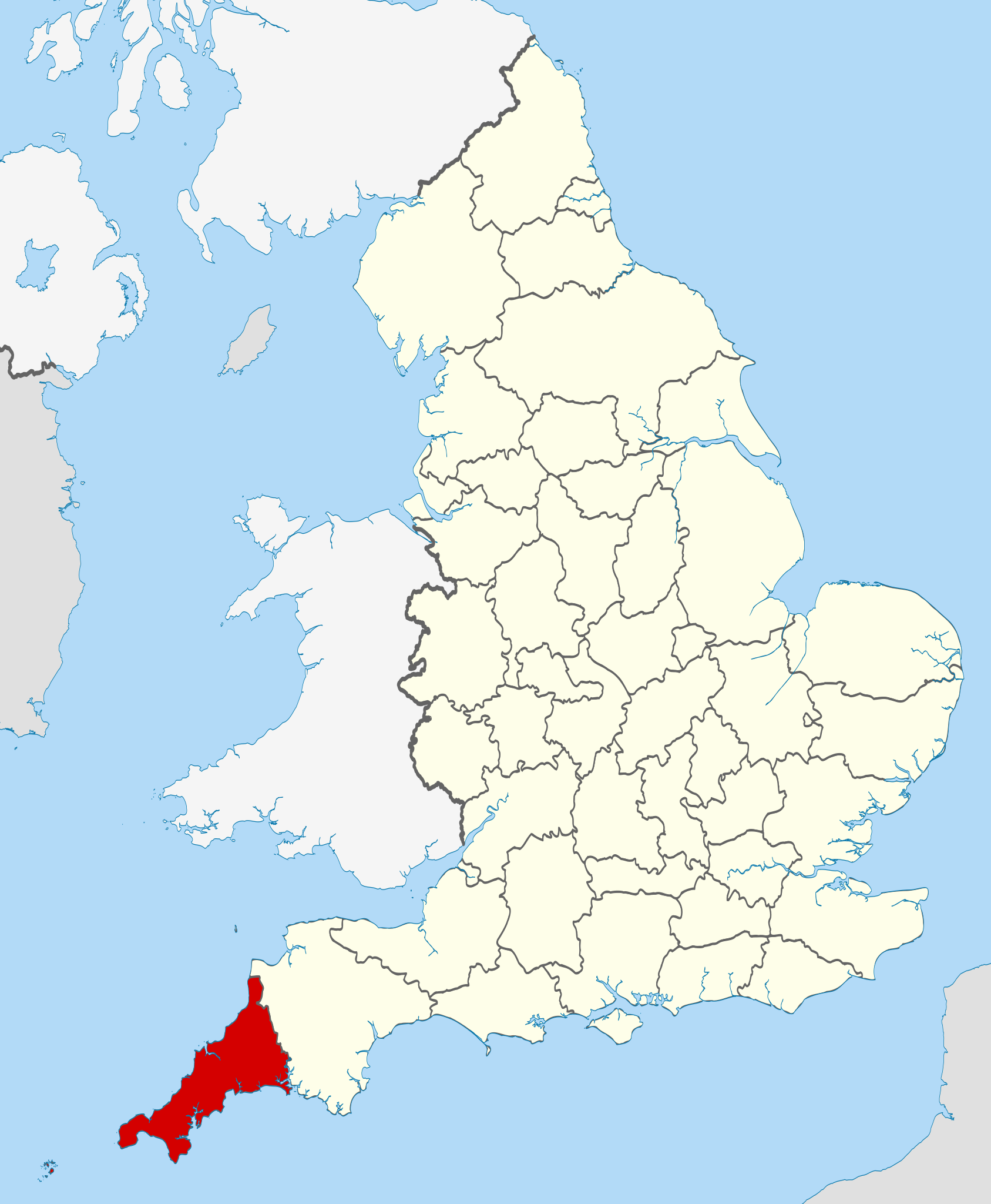
| Besjrieving | Location of Cornwall. |
| Datum | |
| Brón |
National Geospatial-Intelligence Agency
|
| Sjriever | Nilfanion |
Licentie:
Ich, de kopierechhaajer hievan, bring 't hiebie óngere vólgendje lisensje oet:
Dit bestandj steit gelicenseerdj óngere Creative Commons Attribution-Share Alike 3.0 Unported lisensje.
- De maags:
- deile – aafsjrieve, verspreie en dórchgaeve
- hèrminge – 't wèrk aanpasje
- Óngere volgendje veurwaerj:
- Attribuusje – Geer mótj op 'n gepasdje meneer 'n naamsvermeljing make, 'ne link nao de licentie opgaeve, en aangaeve of g'r 't werk verangerd höb. Geer moog dit op eder raejelike meneer doon, meh neet zoea det 't liek ofwen de licentiegaever instump mit eur werk of eur gebroek van zie werk.
- Deil gliek – Went geer dit werk geremix, verangerd of doorverwirk höb, mótj geer 't verangerd matterjaal verspreie ónger dezelfde licentie wie 't oersjprunkelik werk, of 'n licentie die daomit samegeit.

|
Toesteumming wert verleend veur t kopiëre, verspreide en/of wiezige van dit document onger de veurwaerd van de GNU-licentie veur vrieje documentatie, versie 1.2 of einige latere versie es gepubliceerd door de Free Software Foundation; zonger Invariant Sections, zonger Front-Cover Texts, en zonger Back-Cover Texts. n kopie van de licentie is opgenomme in de sectie GNU-licentie veur vrieje documentatie. |
De kens zelf de lisensje oetkeze.

|
This is one of the images forming part of the Valued image set: Locator maps of the Ceremonial counties of England on Wikimedia Commons. The image set has been assessed under the valued image set criteria and is considered the most valued set on Commons within the scope:
Locator maps of the Ceremonial counties of England
You can see its nomination at Commons:Valued image candidates/Locator maps of English ceremonial counties. |
Besjtandjshistorie
Klik op 'ne datum/tied om 't besjtand te zeen wie 't destieds waor.
| Datum/tied | Miniatuurplaetje | Aafmaetinge | Gebroeker | Opmirking | |
|---|---|---|---|---|---|
| hujig | 24 nov 2010 00:27 | | 1.108 × 1.345 (302 kB) | Nilfanion | various tweaks |
| 26 okt 2010 22:44 |  | 817 × 990 (1,33 MB) | Nilfanion | {{Information |Description=Location of Cornwall within England, with the ceremonial counties shown. |Source=Ordnance Survey [https://www.ordnancesurvey.co.uk/opendatadownload/products.html OpenData]: *County boundaries |
Bestandjsbroek
Gein inkel pagina gebroek dit plaetje.
Globaal besjtandjsgebroek
De volgende anger wiki's gebroeke dit bestandj:
- Gebroek in bg.wikipedia.org
- Gebroek in br.wikipedia.org
- Gebroek in ca.wikipedia.org
- Gebroek in ceb.wikipedia.org
- Gebroek in cs.wikipedia.org
- Gebroek in dag.wikipedia.org
- Gebroek in de.wikipedia.org
- Gebroek in en.wikipedia.org
- Cornwall
- Portal:Cornwall
- Grade I listed buildings in Cornwall
- Wikipedia talk:WikiProject UK geography/Archive 11
- List of active separatist movements in Europe
- Grade II* listed buildings in Cornwall (A–G)
- Grade II* listed buildings in Cornwall (Q–Z)
- Grade II* listed buildings in Cornwall
- Grade II* listed buildings in Cornwall (H–P)
- 1977 Cornwall County Council election
- 2005 Cornwall County Council election
- 1997 Cornwall County Council election
- 2001 Cornwall County Council election
- 1981 Cornwall County Council election
- 1985 Cornwall County Council election
- 1989 Cornwall County Council election
- Bossence (surname)
- Vingoe
- 1973 Cornwall County Council election
- 1993 Cornwall County Council election
- 1973 Kerrier District Council election
- Gebroek in en.wikiquote.org
- Gebroek in eo.wikipedia.org
- Gebroek in es.wikipedia.org
- Gebroek in fa.wikipedia.org
- Gebroek in fi.wikipedia.org
- Gebroek in fr.wikipedia.org
- Gebroek in fr.wiktionary.org
- Gebroek in gd.wiktionary.org
- Gebroek in hi.wikipedia.org
- Gebroek in hr.wikipedia.org
- Gebroek in hu.wikipedia.org
- Gebroek in io.wikipedia.org
Bekiek wikiwied gebroek van dit bestandj.