
Plaetje:Philippines relief location map (Mindanao).svg

Aafmaetinge van dees veurbesjoewing van 't type PNG van dit SVG-bestandj: 656 × 486 pixels Anger resoluties: 320 × 237 pixels | 640 × 474 pixels | 1.024 × 759 pixels | 1.280 × 948 pixels | 2.560 × 1.897 pixels.
Oearsprunkelik bestandj (SVG-bestandj, nominaal 656 × 486 pixels, bestandsgruutde: 2,21 MB)
.svg)
Besjrieving
| Besjrieving |
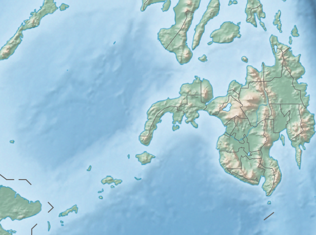
English: Physical location map of the Philippines (Mindanao)
Equirectangular projection based on the parallel of 10°43' N
|
| Datum | |
| Brón | File:Philippines location map (square).svg |
| Sjriever | User:Hellerick |
| Anger versies |
Dit bestand is afgeleid van: Philippines relief location map (square).svg: .svg) |
.svg)
Licentie:
Dit bestandj steit gelicenseerdj óngere Creative Commons Attribution-Share Alike 3.0 Unported lisensje.
- De maags:
- deile – aafsjrieve, verspreie en dórchgaeve
- hèrminge – 't wèrk aanpasje
- Óngere volgendje veurwaerj:
- Attribuusje – Geer mótj op 'n gepasdje meneer 'n naamsvermeljing make, 'ne link nao de licentie opgaeve, en aangaeve of g'r 't werk verangerd höb. Geer moog dit op eder raejelike meneer doon, meh neet zoea det 't liek ofwen de licentiegaever instump mit eur werk of eur gebroek van zie werk.
- Deil gliek – Went geer dit werk geremix, verangerd of doorverwirk höb, mótj geer 't verangerd matterjaal verspreie ónger dezelfde licentie wie 't oersjprunkelik werk, of 'n licentie die daomit samegeit.
Besjtandjshistorie
Klik op 'ne datum/tied om 't besjtand te zeen wie 't destieds waor.
| Datum/tied | Miniatuurplaetje | Aafmaetinge | Gebroeker | Opmirking | |
|---|---|---|---|---|---|
| hujig | 27 okt 2017 16:36 | | 656 × 486 (2,21 MB) | Mliu92 | Updated crop to add missing island. |
| 26 okt 2017 19:23 |  | 573 × 573 (2,21 MB) | Mliu92 | User created page with UploadWizard |
Bestandjsbroek
Gein inkel pagina gebroek dit plaetje.
Globaal besjtandjsgebroek
De volgende anger wiki's gebroeke dit bestandj:
- Gebroek in bcl.wikipedia.org
- Gebroek in bn.wikipedia.org
- Gebroek in en.wikipedia.org
- Sulu Sea
- Moro Gulf
- Mount Apo
- Davao Gulf
- Iligan Bay
- Panguil Bay
- Bud Dajo
- Mount Butung
- Agusan River
- Lake Lanao
- Rio Grande de Mindanao
- Butuan Bay
- Mount Agad-Agad
- Mount Hibok-Hibok
- Mount Makaturing
- Mount Matutum
- Musuan Peak
- Agus River
- Sibuguey Bay
- Illana Bay
- Mount Sumagaya
- Dinagat Island
- Davao River
- Leonard Kniaseff
- Mount Kitanglad
- Macajalar Bay
- Pulangi River
- Cagayan River (Mindanao)
- Mount Dulang-dulang
- Tagoloan River
- Lake Buluan
- Lake Wood (Philippines)
- Lake Dapao
- Mount Malindang
- Mount Kalatungan
- Latukan
- Mount Balatukan
- Mount Hamiguitan
- Mount Baya
- Agusan Marsh Wildlife Sanctuary
- Camp General Basilio Navarro
- 2010 Mindanao earthquakes
- Manupali River
Bekiek wikiwied gebroek van dit bestandj.
.svg)
.svg)