
Plaetje:Philippines relief location map (Palawan).svg

Aafmaetinge van dees veurbesjoewing van 't type PNG van dit SVG-bestandj: 377 × 377 pixels Anger resoluties: 240 × 240 pixels | 480 × 480 pixels | 768 × 768 pixels | 1.024 × 1.024 pixels | 2.048 × 2.048 pixels.
Oearsprunkelik bestandj (SVG-bestandj, nominaal 377 × 377 pixels, bestandsgruutde: 2,21 MB)
.svg)
Besjrieving
| Besjrieving |
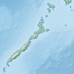
English: Physical location map of the Philippines (Palawan)
Equirectangular projection based on the parallel of 10°43' N
|
| Datum | |
| Brón | File:Philippines location map (square).svg |
| Sjriever | User:Hellerick |
| Anger versies |
Dit bestand is afgeleid van: Philippines relief location map (square).svg: .svg) |
.svg)
Licentie:
Dit bestandj steit gelicenseerdj óngere Creative Commons Attribution-Share Alike 3.0 Unported lisensje.
- De maags:
- deile – aafsjrieve, verspreie en dórchgaeve
- hèrminge – 't wèrk aanpasje
- Óngere volgendje veurwaerj:
- Attribuusje – Geer mótj op 'n gepasdje meneer 'n naamsvermeljing make, 'ne link nao de licentie opgaeve, en aangaeve of g'r 't werk verangerd höb. Geer moog dit op eder raejelike meneer doon, meh neet zoea det 't liek ofwen de licentiegaever instump mit eur werk of eur gebroek van zie werk.
- Deil gliek – Went geer dit werk geremix, verangerd of doorverwirk höb, mótj geer 't verangerd matterjaal verspreie ónger dezelfde licentie wie 't oersjprunkelik werk, of 'n licentie die daomit samegeit.
Besjtandjshistorie
Klik op 'ne datum/tied om 't besjtand te zeen wie 't destieds waor.
| Datum/tied | Miniatuurplaetje | Aafmaetinge | Gebroeker | Opmirking | |
|---|---|---|---|---|---|
| hujig | 26 okt 2017 19:23 | | 377 × 377 (2,21 MB) | Mliu92 | User created page with UploadWizard |
Bestandjsbroek
Gein inkel pagina gebroek dit plaetje.
Globaal besjtandjsgebroek
De volgende anger wiki's gebroeke dit bestandj:
- Gebroek in ban.wikipedia.org
- Gebroek in bcl.wikipedia.org
- Gebroek in en.wikipedia.org
- Busuanga Island
- Tubbataha Reef
- Calamian Islands
- Puerto Princesa Subterranean River National Park
- Mindoro Strait
- Balabac Island
- Mangarin Bay
- Mount Mantalingajan
- Honda Bay
- Calauit Island
- Rasa Island
- Malampaya Sound
- Delian Island
- Module:Location map/data/Palawan
- Module:Location map/data/Palawan/doc
- Bacungan River
- Gebroek in fa.wikipedia.org
- Gebroek in fr.wikipedia.org
- Gebroek in id.wikipedia.org
- Gebroek in ilo.wikipedia.org
- Gebroek in lv.wikipedia.org
- Gebroek in ml.wikipedia.org
- Gebroek in si.wikipedia.org
- Gebroek in uz.wikipedia.org
.svg)