
Plaetje:Map of USA MA.svg

Aafmaetinge van dees veurbesjoewing van 't type PNG van dit SVG-bestandj: 286 × 186 pixels Anger resoluties: 320 × 208 pixels | 640 × 416 pixels | 1.024 × 666 pixels | 1.280 × 832 pixels | 2.560 × 1.665 pixels.
Oearsprunkelik bestandj (SVG-bestandj, nominaal 286 × 186 pixels, bestandsgruutde: 167 kB)
Clickable version
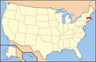
| Besjrieving | Map of USA with Massachusetts highlighted | ||||||||
| Datum | see file history below. | ||||||||
| Brón | own work by uploader, based on Image:Map of USA without state names.svg | ||||||||
| Sjriever |
This version: uploader Base versions this one is derived from: originally created by en:User:Wapcaplet |
||||||||
| Permissie (Hergebroek van dit besjtandj) |
Dit bestandj is gelicenseerd ónger de Creative Commons Attribution 2.0 Generic licentie.
|
||||||||
| Anger versies | image:Map of USA with state names.svg |

Besjtandjshistorie
Klik op 'ne datum/tied om 't besjtand te zeen wie 't destieds waor.
| Datum/tied | Miniatuurplaetje | Aafmaetinge | Gebroeker | Opmirking | |
|---|---|---|---|---|---|
| hujig | 9 jun 2006 09:00 | | 286 × 186 (167 kB) | Huebi~commonswiki | {{Information| |Description=Map of USA with Massachusettes highlighted |other_versions=image:Map of USA with state names.svg }} Category:Maps of the United States Category:Maps of Massachusettes Category:SVG maps {{GFDL-en}}{{cc-by-2.0} |
Bestandjsbroek
Gein inkel pagina gebroek dit plaetje.
Globaal besjtandjsgebroek
De volgende anger wiki's gebroeke dit bestandj:
- Gebroek in af.wikipedia.org
- Gebroek in ang.wikipedia.org
- Gebroek in arc.wikipedia.org
- Gebroek in ay.wikipedia.org
- Gebroek in az.wiktionary.org
- Gebroek in ba.wikipedia.org
- Gebroek in bcl.wikipedia.org
- Gebroek in be-tarask.wikipedia.org
- Gebroek in bi.wikipedia.org
- Gebroek in bpy.wikipedia.org
- Gebroek in bxr.wikipedia.org
- Gebroek in ca.wikipedia.org
- Gebroek in ce.wikipedia.org
- Gebroek in co.wikipedia.org
- Gebroek in cs.wikipedia.org
- Administrativní dělení Spojených států amerických
- Cambridge (Massachusetts)
- Winchendon
- Uxbridge (Massachusetts)
- Provincetown
- Williamstown (Massachusetts)
- Leicester (Massachusetts)
- South Deerfield
- Sterling (Massachusetts)
- Salem (Massachusetts)
- Beverly (Massachusetts)
- Peabody (Massachusetts)
- Concord (Massachusetts)
- Foxborough
- Amherst
- Webster (Massachusetts)
- Fitchburg (Massachusetts)
- Oxford (Massachusetts)
- Shrewsbury (Massachusetts)
- Berlin (Massachusetts)
- Gebroek in cu.wikipedia.org
- Gebroek in cv.wikipedia.org
- Gebroek in da.wikipedia.org
Bekiek wikiwied gebroek van dit bestandj.